| Thu 29 Oct 26 |
|
9.30 am |
Punchbowl Reserve Walk |
Day Walk |
2 |
|
|
Join me for a walk in the Punchbowl Reserve and surrounding area. We will meet in the Punchbowl Reserve carpark for a 9:30am start. This is a lovely area to explore. Bring a drink and morning tea to eat along the way.
|
| Fri 30 Oct 26 |
|
6.30 pm |
Trevallyn Evening Walk |
Evening Walk |
3 |
12 |
|
Trevallyn Recreation Area has lots of bush tracks and is close by. We will meet Friday evening at 6:30pm at the boom gate at the turnoff from Reatta Rd into Duck Reach Rd. Please park vehicles outside the gate, as this is locked at sunset. We'll walk ca. 1 and 1/2 hours till about 8pm, so head torches recommended incase it's a bit dark towards the end. Possible mud, so wear suitable shoes. No planned route, there's lots of options, this is a local park but there are plenty of very steep tracks, bike trails and rougher narrow trails to explore on foot. Expect a short grade 3 walk.
|
| Fri 30 Oct 26 |
|
9.00 pm |
Langana Special 80th Anniversary Edition - Printed Copy |
Miscellaneous |
|
|
|
Register for this event if you wish to receive a printed copy of this year's 80th Anniversary special edition of Langana.
Preparation of the magazine is in its advanced stages and it promises to be a bumper edition of approximately 80 pages!
The actual cost to each member will depend on the eventual size of the magazine and on the number of people that order one, but it is expected to be between $25 and $35 per copy, plus an additional $5 if you want it posted to you. The actual cost will be advised during the first week in November.
If you wish to collect your magazine in person, you can do so at the club's general meeting on Wednesday, November 18. You will need to have paid before this meeting to be able to collect your copy,
|
| Sun 1 Nov 26 |
|
8.00 am |
Rubicon Kayak |
Kayak Trip |
K1 |
15 |
$25 |
It will be low tide about 9.00am. The plan is to paddle from the River mouth up to the Frankford Highway bridge with an incoming tide.. The Rubicon Estuary is very underrated. We will have a couple of stops on our explore.
Expect about 13-14 kms of leisurely paddling.If you need to borrow a kayak, please contact the coordinator before registering.
|
| Mon 2 Nov 26 |
|
10.00 am |
Misery Bluff |
Day Walk |
3 |
15 |
$24 |
Misery Bluff offers great views. It is a short drive to our nearest National Park. We will start at Carr Villa. It is a steady climb to the plateau on the Carr Villa to Legges Tor track.We will then be off track to the summit for lunch.There is some scree and scrub but we usually manage to avoid most of it.
|
| Fri 6 Nov 26 |
|
6.30 pm |
Trevallyn Evening Walk |
Evening Walk |
3 |
12 |
|
Trevallyn Recreation Area has lots of bush tracks and is close by. We will meet Friday evening at 6:30pm at the boom gate at the turnoff from Reatta Rd into Duck Reach Rd. Please park vehicles outside the gate, as this is locked at sunset. We'll walk ca. 1 and 1/2 hours till about 8pm, so head torches recommended incase it's a bit dark towards the end. Possible mud, so wear suitable shoes. No planned route, there's lots of options, this is a local park but there are plenty of very steep tracks, bike trails and rougher narrow trails to explore on foot. Expect a short grade 3 walk.
|
| Sat 7 Nov 26 |
Sun 8 Nov 26 |
5.00 am |
Mt Weld |
Backpack Walk |
5 |
10 |
$55 |
Mt Weld is an Abel surrounded by several well-known peaks including Mt Anne, Snowy South and Mt Picton. The plan involves driving early from Launceston to the start of the track and then hiking to a campsite just below the summit. We will aim to leave Launceston by 05:00am on Saturday as we have to drive a long distance to the starting point around 36km past Judbury. We then have a walk of around 7hrs to the campsite. After pitching our tents near an unnamed tarn below the peak, we may either aim for the summit in late afternoon or in the morning next day before returning to our cars and Launceston on Sunday. Please note that the coordinators haven't done this walk before. Please also come prepared for cutting grass and scrub. The final ascent involves some scrambling over boulders.
|
| Sat 7 Nov 26 |
|
6.30 am |
Ritters Plain and Devils Gullet Explore |
Day Walk |
3 |
12 |
$40 |
Ritters Plain is located to the west of Lake Mackenzie. It has a Poimema on it and we will visit this as we complete a circuit around the cliff edge of Devils Gullet, southern side. Fantastic views and an area not often visited but well worth the trip. If time permits we can visit Parsons Falls on the way out, hopefully the Fisher River has plenty of water in it.
|
| Sat 7 Nov 26 |
|
7.00 am |
Yingina / Reynolds Neck to Breona Kayak |
Kayak Trip |
K1 |
12 |
$25 |
The weather has thwarted us in the past so hopefully we will get to paddle this adventure. The wind will dictate whether we start at Reynolds Neck and finish at Breona or do it in the opposite direction.
Expect about 15 kilometres of leisurely paddling.
|
| Sun 8 Nov 26 |
|
7.00 am |
Mt Dromedary and Platform Peak |
Day Walk |
3 |
17 |
$47 |
A previous attempt at Mt Dromedary in late 2025 saw us fail to reach the summit of Mt Dromedary, not least because a misfiring bus (at the time) saw us start the walk far too late. As a result, we’re going to have another attempt
The plan this time, rather than walking from Black Hills like we did last time, is to get a key from Sustainable Timber and begin our walk much closer to the Dromedary summit. This should allow us enough time to climb Dromedary and also visit the summit of Platform Peak on the same day. Both peaks are Poimenas and offer superb views of the Derwent and the area to the north of Hobart.
|
| Mon 9 Nov 26 |
|
7.00 am |
Interlaken to Hamilton Bike via Bothwell |
Bike Trip |
B1 |
18 |
$47 |
This event will be on about half gravel and half sealed roads. Expect about 50 km of undulating riding with spectacular views. From Bothwell to Hamilton there are a couple of hills that we will avoid on the bus. Register early as this will be a popular ride.
|
| Tue 10 Nov 26 |
|
9.30 am |
Gorgeous Tuesday |
Day Walk |
2 |
|
|
Join me for a walk in the fantastic Cataract Gorge, right on the doorstep of central Launceston. Meet at the Alexandra Suspension Bridge on the pool side of the First Basin for a 9:30am start. Be prepared for steps and some uneven ground. Bring a drink and check the weather forecast prior to the walk. We will have morning tea at the First Basin Cafe at the conclusion of the walk.
Map: Getting Around the Gorge
|
| Thu 12 Nov 26 |
|
8.30 am |
Derby - Branxholm Bike Both Ways |
Bike Trip |
B2 |
15 |
$29 |
We will ride the easy/beginner MTB trail on Valley Pond Branxholm Derby Link both ways, and have time for coffee in Branxholm.
Valley Pond Branxholm Derby Link introduces features such as berms and rollers, and it follows the very pretty Ringarooma River. There are giant manferns along this shady trail and spots to picnic at Valley Ponds. In Derby we will do a loop trail of the lake.
Finish at the lake... it may be warm enough for a refreshing swim at the beach!
|
| Fri 13 Nov 26 |
|
6.30 pm |
Trevallyn Evening Walk |
Evening Walk |
3 |
12 |
|
Trevallyn Recreation Area has lots of bush tracks and is close by. We will meet Friday evening at 6:30pm at the boom gate at the turnoff from Reatta Rd into Duck Reach Rd. Please park vehicles outside the gate, as this is locked at sunset. We'll walk ca. 1 and 1/2 hours till about 8pm, so head torches recommended incase it's a bit dark towards the end. Possible mud, so wear suitable shoes. No planned route, there's lots of options, this is a local park but there are plenty of very steep tracks, bike trails and rougher narrow trails to explore on foot. Expect a short grade 3 walk.
|
| Sat 14 Nov 26 |
|
6.00 am |
Mt Tor |
Day Walk |
4 |
10 |
$50 |
Mt Tor is just an Abel in terms of height at 1110+ m but it is certainly a good challenge and is linked to the Black Bluff Range. The walk starts 13.5km from the Leven Canyon turnoff. It is best to bring river shoes with you as from the outset there is water to be encountered. The Dempster Creek is crossed then the track is followed for 400m to the Leven River. Hopefully there will not be too much water flowing to allow a safe passage. The track follows the river, crosses Tor Creek and then steepens into a forest. The walk follows pads uphill, through buttongrass, tea tree, gums, and bauera is to be avoided. Buttongrass slopes and tea tree is encountered before a rocky ridge line of boronia, scoparia and boulders at the summit of Mt Tor is reached after 3 hours. The whole walk is approximately 6 hours and great views will hopefully be gained from the summit, including Cradle Mountain and Barn Bluff. This is a harder walk for experienced walkers. Please talk to me if you have any queries. Please come prepared for all conditions.
|
| Sat 14 Nov 26 |
|
8.30 am |
Table Mountain Day Walk |
Day Walk |
2 K1 |
12 |
$42 |
Please note that this walk involves a 4 km paddle across Lake Crescent and a 12 km return walk to the summit. It is a 4 km paddle back to the bus. If you need to borrow a kayak please contact the coordinator BEFORE registering.
|
| Sun 15 Nov 26 |
|
7.00 am |
Remarkable Rock |
Day Walk |
3 |
16 |
$37 |
Remarkable Rock reserve is located alongside the Ouse River, south of Miena and features Basalt Rock formations amidst a lovely subalpine environment. The walk involves two crossings of the river, possibly wet feet and cancellation of the walk if the river is too high. If we need to cancel we will visit Skittleball Hill and Lake Fergus which are nearby, instead. Remarkable Rock is an amazing destination and more than worthy of its reserve protection. Ten kilometres maximum and little over 100 metres of altitude gain/loss.
|
| Sun 15 Nov 26 |
|
8.00 am |
Lake Cethana Kayak |
Kayak Trip |
K1 |
15 |
$25 |
The plan is to put in at the northern end of the lake near the dam wall. We will explore south to where the Dove River enters and then return to our starting point. Expect about 15 KMS of leisurely paddling.
|
| Mon 16 Nov 26 |
|
7.00 am |
Hobart Cycleway Bike |
Bike Trip |
B1 |
18 |
$42 |
The plan is to ride the Hobart Cycleway from MONA to Salamanca. We will have lunch there and then ride back to MONA. There will be the option to check out the new library at MONA before we head back to Launceston on the Club bus.
Expect about 40 km of leisurely riding. If there is interest, we could catch a ferry from Salamanca to Bellerive and ride across the Tasman Bridge and then to MONA. Let me know if you are interested in this option.
|
| Wed 18 Nov 26 |
|
7.00 am |
Little Horn Day Walk |
Day Walk |
4 |
12 |
$42 |
The plan is to walk up the Truganni and Face Tracks and have lunch on the summit of Little Horn. We will then complete the clockwise circuit by descending to Lake Wilks, Ballroom Forest and the boat shed. This is a classic walk, rated an easy Grade 4. It is about 20 minutes from the Face Track to the summit. Some may like to join this adventure and not go up to the summit. We will be able to take our Club bus to Romney Creek carpark.
|
| Wed 18 Nov 26 |
|
7.00 pm |
Club Meeting: 2026 George Perrin Photographic Competition |
Club Meeting |
|
|
|
We all take plenty of photos of our adventures, but did you capture that "bang for buck", sharp, great composition and colours!
This is the competition for you!
Club members are encouraged to submit a single Tasmanian image taken in the past three years.
- Photos must not have been entered in any previous club photographic competition.
- No watermarks/signatures.
- Only 2026 financial club members are eligible to enter.
- Maximum of three (3) entries per member.
- 2026 judge to be announced closer to the date.
Prizes
- 1st prize: $100
- 2nd prize: $75
- 3rd prize: $50
- Entries close Friday 6th November. USB stick can be dropped off at the October club meeting or upload and email photos to karenprince@launcestonwalkingclub.org.au
When: 18th November
Where: Newstead College, Cypress St, Launceston
Time: 7pm for light supper and catch up with old mates and make new friends *Gold coin donation
Meeting starts: 7:30 pm
Meeting closes: 9pm
|
| Thu 19 Nov 26 |
|
9.30 am |
George Town to Bell Buoy Beach |
Day Walk |
2 |
15 |
$24 |
We will commence at George Town and follow the path to Low Head. After lunch we will walk the beaches to Bell Buoy Beach. Our bus driver will pick us up there, making this a mostly flat, through trip.
|
| Fri 20 Nov 26 |
|
6.30 pm |
Trevallyn Evening Walk |
Evening Walk |
3 |
12 |
|
Trevallyn Recreation Area has lots of bush tracks and is close by. We will meet Friday evening at 6:30pm at the boom gate at the turnoff from Reatta Rd into Duck Reach Rd. Please park vehicles outside the gate, as this is locked at sunset. We'll walk ca. 1 and 1/2 hours till about 8pm, so head torches recommended incase it's a bit dark towards the end. Possible mud, so wear suitable shoes. No planned route, there's lots of options, this is a local park but there are plenty of very steep tracks, bike trails and rougher narrow trails to explore on foot. Expect a short grade 3 walk.
|
| Sat 21 Nov 26 |
|
7.00 am |
Hazards Beach Circuit |
Day Walk |
3 |
13 |
$42 |
Now I don't want to tempt fate, but with 'summer just around the corner', let's hit the East Coast for a spectacular coastal walk and optional dip in the ocean. The walk is about 12km with around 400m elevation over the day.
We'll follow the track up to the look out and over to Wineglass Bay (the steepest part of the day) before crossing at the isthmus. The walk will then take us back along Hazards Beach and through beautiful she-oak forest before we're spoiled with a magnificent display of xanthorrhoea (grass trees).
Bring your lunch and a day pack with plenty of water and sun protection as we aren't under tree cover for a lot of the walk.
I'll never forgive myself for the sad faces when last time I said not to put your togs and towel in your day pack and the day opened up to be hot and sunny when we popped out at Hazards Beach*, so this time pack them just in case!
* Conditions may vary from last time and not be hot and sunny, although may still be perfect for a quick dip at lunch.
|
| Sat 21 Nov 26 |
Mon 23 Nov 26 |
7.00 am |
Moores Bridge, Mt Alexandra |
Backpack Walk |
4 |
7 |
$65 |
Southern Ranges
This location is rarely visited by our club and it's been on my radar for a long time (the 2024 and 2025 trips were cancelled). Moores Bridge is named after the well-known explorer and track builder, Thomas B Moore. It’s accessed just off the Moonlight Ridge Track into the Southern Ranges. The area is very beautiful and wild.
Three days are required for this trip, starting with the 4-hour drive on the Saturday morning to the start on the Lune River Road. Our party will walk up the hill on the Moonlight Ridge Track (8-9 km with about a 900m climb) to our base camp at Moores Bridge or nearby.
Sunday, we will carry day packs out to Mt Alexandra (930 m) over undulating open moorlands past Moores Gardens and numerous pools and tarns. This will be a pleasant walk of 12km return in total, off-track but there won’t be much climbing as we are starting the day at the 900m level. The last small climb is only about 90m.
Monday, we will retrace our steps to the vehicles and drive home. Come and join me for a great long weekend. (Let's cross our fingers for good weather.)
|
| Sat 21 Nov 26 |
|
9.00 am |
Navigate with Map and Compass |
Day Walk |
2 |
6 |
|
This is a practical "hands on" training event to teach the basic aspects of land navigation using a map and compass. Subjects covered in training will be as follows:
- The differences between True North, Grid North and Magnetic North.
- Grid references, grid lines and map interpretation, including map scale and reading contours.
- Orientating a map to the ground with and without a compass.
- Taking a bearing from a map (grid bearing).
- Converting a grid bearing to a magnetic bearing.
- Estimating/measuring distance to an objective.
- Moving on a bearing to a selected objective, using the principle of "aiming off".
- Counting paces and estimating movement time in open country and close country.
The basic theory will be covered in the first hour at the Apex Hut. We will then spend 3-4 hours moving on a compass bearing from point to point, reading the ground and estimating distance. As members gain confidence with using a compass, they may wish to break into groups of two or individually and navigate on their own route back to a finish point.
Equipment: Bring a daypack, chair or stool, notebook and pencil and an adjustable dial compass (sometimes called a baseplate compass - examples include such brands as Silva and Suunto). Maps will be provided. Several club compasses will be available to use if you do not have a compass for this training.
Transport: Own vehicle to Apex Hut, Lake Trevallyn Road, Trevallyn Nature Recreation Reserve.
This event would be useful for Prospective and New Members. All Members are welcome. At the end of this training, you will have the basic knowledge to continue developing your navigation skills by map reading (reading the ground) while participating in club walks. This event will finish at or about 3 pm.
|
| Sat 21 Nov 26 |
|
9.00 am |
Wayarupi / Meander River Kayak (Quamby to Hadspen) |
Kayak Trip |
K1 |
15 |
|
We will put in near Hagley and finish at Hadspen. Expect about 16 km of leisurely paddling with a couple of easy Grade 1 rapids to add a bit of adventure. Longer sea kayaks will not be suitable.
|
| Sun 22 Nov 26 |
|
8.00 am |
Sheffield Bike Circuit |
Bike Trip |
B1 |
16 |
$29 |
The club rode this course only a few years ago and the ride is back by great popular demand, with only a few small changes to the route. We’ll begin in Sheffield and ride north towards Nook before looping around to Barrington. We continue south via Nowhere Else and West Kentish and then through backroads down to Claude Road. From there we follow Claude Road from Claude Road (no, really!) into Sheffield to finish.
The ride is only 35km long but it features a few challenging hills – although it’s very much worth it because we’ll be riding through some of the most spectacular rural and mountain scenery the state has to offer. Hi-vis clothing is absolutely essential because we may encounter a bit of traffic, particularly in the final section from Claude Road to Sheffield.
|
| Mon 23 Nov 26 |
|
7.00 pm |
Four Springs Night Kayak |
Kayak Trip |
K1 |
15 |
|
This adventure will be about 8-10 km of leisurely paddling. We will have tea at the boat ramp and then explore. There will be plenty of wildlife on the water and on the shoreline.
Bring a head torch as it will be getting dark when we finish.
|
| Fri 27 Nov 26 |
|
6.30 pm |
Trevallyn Evening Walk |
Evening Walk |
3 |
12 |
|
Trevallyn Recreation Area has lots of bush tracks and is close by. We will meet Friday evening at 6:30pm at the boom gate at the turnoff from Reatta Rd into Duck Reach Rd. Please park vehicles outside the gate, as this is locked at sunset. We'll walk ca. 1 and 1/2 hours till about 8pm, so head torches recommended incase it's a bit dark towards the end. Possible mud, so wear suitable shoes. No planned route, there's lots of options, this is a local park but there are plenty of very steep tracks, bike trails and rougher narrow trails to explore on foot. Expect a short grade 3 walk.
|
| Sat 28 Nov 26 |
|
6.30 am |
Working Bee |
Day Walk |
5 |
10 |
$0 |
We tackle Mother Cummings Rivulet Track, marking areas that need it and track clearing no doubt using all our equipment. Parks will provide more information when they have gone through their workload, this will be nearer the time.
|
| Sat 28 Nov 26 |
Sun 29 Nov 26 |
7.00 am |
Walls Lakes Circuit |
Backpack Walk |
4 |
8 |
$40 |
This will be a not too difficult weekend trip that will be all about the enjoyment of backpacking and camping beside a lake with your tent in an idyllic location. There will be plenty of opportunity for swimming, fishing and enjoying the sunset over a slow camp dinner. There is plenty of scope for wandering different routes in this central highlands area.
|
| Sun 29 Nov 26 |
|
7.30 am |
Boobyalla River Circuit |
Day Walk |
3 |
18 |
$29 |
A visit to the Boobyalla River Tract, located south of Tomahawk and just north of Little Mt Horror, provides a rare opportunity to experience a forest that still contains Eucalyptus ovata (swampgum) and Eucalyptus obliqua (stringybark) – the remainder of a landscape that was much more common before clearing for farming. The 7km walk takes us along both sides of the Boobyalla River, is mostly flat, on a marked but not formed track and involves three river crossings: two on logs and one on stepping-stones. There are some patches of scrub in places. We’ll encounter two water races: White Rock Race and Wares Race. We’ll stop at Billy Bank and view the "Truganina Tree" – two features visited by George Augustus Robinson and his largely aboriginal entourage (including Truganina) on his 1831 journey through the North East. As the walk will probably take about 4 hours I’ll plan another short one in the area for later in the day – TBA.
|
| Sun 29 Nov 26 |
|
12.00 pm |
Kayak Skills |
Kayak Trip |
K0 |
18 |
|
We will meet at the Waverly Lake. Bring a wetsuit and change of clothes. The plan is to skill up on paddling and bracing strokes, experience capsize and re-entry, both assisted and individual. Some may also like to try out different kayaks.
|
| Mon 30 Nov 26 |
|
8.00 am |
Miena to Bothwell Bike via Waddamana |
Bike Trip |
B2 |
18 |
$37 |
This adventure is mostly on gravel roads with more downhill sections than uphill. We will have morning tea at Waddamana and check out the Power Station Museum. The uphill section out of the village will be on the bus. The last part to Bothwell will be on the sealed Highlands Lake Road. Expect about 60 kilometres of leisurely riding with bus support.
|
| Tue 1 Dec 26 |
|
6.00 pm |
Mt Direction in the Evening |
Evening Walk |
2 |
16 |
$24 |
A chance to celebrate the start of summer with a short evening walk up Mt Direction to view the historic ruins of the old signal station and semaphore. We can enjoy supper at the top and a little explore around the ruins or for those more energetic there is opportunity for a short explore down the other side to the southern boundary of the reserve.
This track is clear and in good condition, although steep in sections, however there are a few benches along the way to rest and enjoy the Tamar views. Bring a drink & snacks, your head torch and a warm jacket in case it cools with the setting sun.
|
| Wed 2 Dec 26 |
|
8.00 am |
Burnie Urban Fringe Frolic (BUFF) |
Day Walk |
1 |
20 |
$42 |
The Launceston Urban Fringe Trail (LUFT) was designed about a decade ago, and has proved very popular, not least with the LWC. Our north-west members Christine Dennis and Phil Hays have come up with their own trail around the perimeter of inner Burnie, and they would like to show it to us!
We will meet Chris and Phil at Burnie Yacht Club and they will take us around a circuit of approximately 12km, with an option of further walking around Cooee if we want it. There will be a bit of uphill at the start as we head up to South Burnie, but after that it will be mainly flat or downhill. On the way we will travel through a few parks with toilets and good places to stop for snacks - and as it happens, we may also go past a few coffee shops!
Much of our walking will be on footpath so heavy duty boots are not needed - a sturdy pair of runners should be sufficient. Also, given that we finish back at the yacht club, there is also an option for a swim at the end if anyone is interested - so bring your swimmers!
|
| Fri 4 Dec 26 |
Sun 6 Dec 26 |
5.00 pm |
Snowy North |
Base Camp Walks |
5 |
8 |
$65 |
This weekend will involve a lengthy hike to a mostly untracked Abel: Snowy North.
It is a challenging and difficult 11km hike with an elevation gain of 815m. This hike will include some very steep gradients, a myrtle forest and some prickly bushes. There is open walking terrain once you hit the plateau. Please note that neither co-ordinator has hiked into Snowy North before. In good weather, there are stunning views of the surrounding mountains.
The intention is to drive down to Maydena on Friday evening and camp. An early rise will allow us to drive to the start of the walk to Snowy North and then hike the 8+ hour day hike to the summit of Snowy North and back. Overnight camp at Mt Field camping grounds (where there are showers and toilets and bbqs) with a Sunday morning walk around the waterfalls (Russell Falls, Horseshoe Falls, Lady Barron Falls). We should be back on the road to Launceston by approximately 3pm.
This hike is aimed for experienced hikers due to the terrain and the length of the hike.
|
| Sat 5 Dec 26 |
Tue 8 Dec 26 |
7.00 am |
Powena Creek Ascent |
Backpack Walk |
5 |
8 |
$37 |
Walk will start from Lake Ada following the O'Dells Lake track south, pausing for morning tea at Bulls Hill hutsite. We then follow delightful open leads westerly, after 12 kilometres we shall visit Lina Tarn. We turn left here and finish off day 1 with 2 kilometres cross country to reach camp at Lake Antimony. Unknown terrain which may house some scrub.
Day 2 we follow Terese Lagoon track north for 1.8 kilometres before crossing "our" target stream, the Powena Creek, to its western bank. Now the real adventure begins, tracing the creek to its source. We sidle Lake Fanny before lunch, then continue north west crossing Ritters Track after 13 kilometres. Camp tonight could be beside any of a myriad lakes and possibly Lake Nutting.
Day 3 direction quite northerly now initially around Lake Nutting, then Daisy Lakes. This truly is pencil pine central! Mersey Crag looms nearer now as our stream is becoming ever smaller. After a final climb onto Richea Ridge we arrive at the Powena Creek source; a tiny tarn at 1385 metres. Packs can be dropped for the climb of Mersey Crag, we then descend onto Clumner Plateau to reach tonight's camp, an unnamed lake after 14 kilometres.
Day 4 we follow the outlet creek before descending off track for 600 metres to the bank of the Little Fisher River.. We can now follow the river downstream through a gorgeous rainforest to arrive after 12 kilometres at the club bus.
This walk is 90% off track so participants will be vetted for experience and equipment. Expect 55 to 60 kilometres with up to 1000 metres of ascending and descending. Mostly the terrain is quite friendly but there can be no guarantees.
|
| Sat 5 Dec 26 |
|
8.00 am |
Briggs 1: Yellow Ochre and Ironstone |
Day Walk |
2 |
14 |
$35 |
Briggs Regional Reserve is one hour's drive from Launceston and is an area of roughly 100 square kilometres of forest west of Beaconsfield and Yorktown. It consists of lowland coastal forest and has an extensive network of old logging roads, fire trails, 4WD and trial bike tracks. It is also a part of Tasmania's history with known places of ochre, iron ore, chromite and asbestos (the safe variety). It was also the first place in Tasmania where dynamite was used. Nigel Burch in his book, An Iron Will, states it is also where the Tasmanian tiger (thylacine) was discovered and where the first described fossil taxon was discovered, both in 1805.
The walks will be mostly on tracks except for the odd location where we may need to cut through 100 - 200 metres of low scrub to cut onto another track.
These will be grade 2 walks of between 10-12 km and our rate of movement will be roughly 2.5 km an hour. Our highest climb will be no more than 250 metres. The coordinator will have spare maps to hand out to anyone who wishes to practice map reading along the way.
This walk will be a stroll in the Andersons Creek area where iron ore was first discovered in Australia. We will visit a yellow ochre pit, a vertical mine and the open cast Mt Vulcan mine as well as walking over a low hill feature called the Ironstone Hills.
|
| Sun 6 Dec 26 |
|
9.00 am |
Kayak Training Day at Cataract Gorge |
Training |
K0 |
15 |
|
This will be a Training Day to learn bracing, self rescue - individual and assisted, entering and exiting your kayak and rolling. Bring a wetsuit. or bathers and rashie, goggles or face mask. We will be there from 9-2. Some people may only come for some of the time. A warm change of clothes may be helpful. There are toilets, change rooms and a cafe nearby. Parking may be an issue. Some people may choose to not get wet and upskill their bracing and strokes.
|
| Wed 9 Dec 26 |
|
8.00 am |
Briggs 2: Sheepwash Hills Circuit |
Day Walk |
2 |
14 |
$29 |
Briggs Regional Reserve is one hour's drive from Launceston and is an area of roughly 100 square kilometres of forest west of Beaconsfield and Yorktown. It consists of lowland coastal forest and has an extensive network of old logging roads, fire trails, 4WD and trial bike tracks. It is also a part of Tasmania's history with known places of ochre, iron ore, chromite and asbestos (the safe variety). It was also the first place in Tasmania where dynamite was used. Nigel Burch in his book, An Iron Will, states it is also where the Tasmanian tiger (thylacine) was discovered and where the first described fossil taxon was discovered, both in 1805.
The walks will be mostly on tracks except for the odd location where we may need to cut through 100 - 200 metres of low scrub to cut onto another track.
These will be grade 2 walks of between 10-12 km and our rate of movement will be roughly 2.5 km an hour. Our highest climb will be no more than 250 metres. The coordinator will have spare maps to hand out to anyone who wishes to practice map reading along the way.
For this walk we will park at the junction of Bowens Road and Kerrisons Road (the highest point on the road between Yorktown and Port Sorell) before heading NW along a fire trail to Barretts Lookout where we may get good views of Port Sorell and Bakers Beach. We will then continue down to Sheepwash Creek, then follow a track along the Sheepwash Hills back to our vehicles. We will be back in time to attend the LWC BBQ.
|
| Wed 9 Dec 26 |
|
5.30 pm |
Christmas BBQ |
Social Event |
|
|
|
Join fellow club members in celebrating Christmas, with a shared barbecue at the Trevallyn Dam, which is located within the Trevallyn Nature Recreation Area and is less than a 10-minute drive from Launceston’s CBD.
Please BYO barbecue food along with a salad or sweet to share, preferably Christmas-themed and BYO chairs, plates, utensils, and drinks.
Don’t forget your Santa hat and Christmas-themed clothing.
This event is well known for lots of delicious Christmas fare and the Social Committee are looking forward to you joining them for the annual Christmas barbecue. See you there!
|
| Sat 12 Dec 26 |
Sun 13 Dec 26 |
7.00 am |
Takayna Base Camp |
Base Camp Walks |
2 |
15 |
$52 |
The plan for this base camp weekend is to visit Dip Falls,Stanley, Matula-The Nut and Premenghana- Marrawah on the Saturday. We will camp at Marrawah, close to the beach.On Sunday, we will visit Nungu-West Point, Edge of the World at Arthur River, Milkshake Hills, Lake Chisholm, Trowutta Arch, the caves at Pinmatik- Rocky Cape National Park and maybe a swim at Pattengara-Boat Harbour Beach.
|
| Sat 12 Dec 26 |
|
7.30 am |
Headlam Hill and Split Rock Circuit |
Day Walk |
4 |
12 |
$35 |
In the same vein as my Breona and Pine Lake Tiers trip earlier this year, this is another off-track adventure involving two adjacent Poimena high points. Both features are just north of Liawenee on the western side of the Great Lake (ie this Split Rock is not the well-known Meander Valley one). After parking vehicles off the Highland Lakes Road we’ll commence the ascent of Headlam Hill (1296m). Both The Poimenas Part B and a recent video (https://www.youtube.com/watch?v=UeFyZWL439Q – it’s slow-moving so just skip through it) show that the walking is mainly open (partly due to a large bushfire in 2019) with some small patches of scrub, but quite rocky for much of it, so if you’re not comfortable on scree and boulders then this isn’t the trip for you.
The walking distance between the two peaks is just over 2km and only involves descending 50m to the saddle between the two of them. On offer are great views of Great Lake and heaps of surrounding peaks including Drys Bluff, Ben Lomond, the Wellington Range, Frenchmans Cap, Mt Ossa etc. Once at Split Rock (1320m) the book suggests returning by the same route but, instead, I’d like to make a circuit of the trip by descending directly to the highway. Total walking time is in the order of 5 hours. Again, this should be a great day out for those that enjoy more challenging walking in an area rarely visited.
|
| Sat 12 Dec 26 |
|
9.30 am |
Liffey Falls from Lower Carpark |
Day Walk |
2 |
13 |
$30 |
We will commence our walk from the lower Liffey Falls campground. The walk follows the Liffey River through beautiful rainforest to the Liffey Falls. We will have an early lunch at the falls before retracing our steps. Come along for a lovely 5.8km walk.
|
| Sun 13 Dec 26 |
|
8.30 am |
Mt Barrow |
Day Walk |
2 |
19 |
$30 |
A club trip to Mt Barrow in May encountered some really dismal weather, resulting in the decision not to proceed all the way to the summit. We’ll be trying again, but this time at a time of year when our chances are better and the wildflowers should be worth the walk anyway.
We will again be starting our day at the picnic shelter at the bottom of the mountain – perhaps with a short walk around the nature trail – and then ascending about 350m by walking up the road to the car park near the top. From there, we’ll attempt to do the summit straight away (climbing another 150m or so), and then we have the rest of the day to go off-track to enjoy the wildflowers on the plateau. It is also on the cards to visit the towers at South Mt Barrow and get a great view to the east.
|
| Mon 14 Dec 26 |
|
7.00 am |
Gladstone to Gardens Bike |
Bike Trip |
B2 |
18 |
$47 |
Our last adventure to the North East was very popular. This time we will start at Gladstone and visit the Blue Lakes on the way to Pioneer. Then we will head towards Gould's Country on undulating gravel roads before a short single track section of the Blue Tier to Blue Seas Track. This is rated light green difficulty. After that more scenic gravel roads to the coast for a swim at our finish at the Gardens. Expect about 50 km of leisurely riding MTB and / or hybrid bikes will be best.
|
| Tue 15 Dec 26 |
|
9.00 am |
1st LWC Walk - Trevallyn Bridge-Duck Reach-Third Basin |
Day Walk |
3 |
|
$19 |
This walk will be a nod to the first walk of the Launceston Walking Club, which was held on 15/12/1946.
|
| Wed 16 Dec 26 |
|
9.30 am |
Trevallyn Reserve Walk |
Day Walk |
2 |
14 |
|
We will meet at Aquatic Point at Lake Trevallyn ready for a 9:30am departure. Our walk will take us along the Aquatic Point Track to the Trevallyn Dam and then along the South Esk Track to the Hoo Hoo Hut area, where we will have a morning tea break, and the return the same way. The return walk is 6.2km on an undulating and sometimes rocky track. I look forward to your company on the walk.
|
| Wed 16 Dec 26 |
|
7.00 pm |
Club Meeting, Christmas Nibbles and Presentation by an LWC Life Member Maria Monypenny: 158 Abels |
Club Meeting |
|
|
|
Club Meeting, Christmas Nibbles and Presentation by an LWC Life Member Maria Monypenny: 158 Abels
|
| Thu 17 Dec 26 |
|
9.00 am |
Adams Peak |
Day Walk |
4 |
12 |
$29 |
This 1300m high peak rises beside Pine Lake and is a prominent feature when viewed from the Lakes Highway. Waratah and scoparia should be flowering in magnificent form at this time of year. The walk will begin on the boardwalk, but progress to alpine moorland, light scree and light scrub, with some rock scrambling close to the summit. There are great views over the northern part of Central Plateau. A short walk of a few hours but bring lunch and water.
|
| Fri 18 Dec 26 |
|
7.00 am |
Mt Maurice |
Day Walk |
3 |
10 |
$35 |
It has been a few years since the club has hiked into Mt Maurice. Having explored this Abel in January 2026, I am keen to revisit this wonderful walking track.
The intention is to either park at the ricketty bridge and walk along Knights Road to the beginning of the track - this may require a few extra kilometres of walking. Alternatively, if the bridge is looking crossable and we have members who are happy to attend and drive their 4WD vehicles, we can commence the walk at the original starting point. Either way will make for a pleasant walking day.
Please note that a good level of fitness is required if we are walking from the bridge as the extra kilometres do add up.
|
| Sun 20 Dec 26 |
|
6.00 am |
Clumner Bluff |
Day Walk |
4 |
12 |
$40 |
Clumner Bluff is an Abel accessed from the Mersey Forest Road and the Fish River Road. The walk commences at altitude of 640m and follows a trail up to the Fish River Road (which loops around). The walk to the summit is about 3 hours from this location from an altitude of 880m with the summit at 1458m. The walk is quite steep and confidence on scree is necessary. Boulders are then encountered along with another cairned route across a scree field, prior to some vegetation and more scree.
The views on this walk are wondrous on a clear day which I hope to gain in December. This is a walk for confident experienced walkers. The walk will take 7-8 hours and hopefully the weather will be accommodating but please come prepared for all weather conditions. Please have a talk to me if you have any questions.
|
| Mon 21 Dec 26 |
Tue 22 Dec 26 |
10.00 am |
Ben Lomond Summer Solstice Campout |
Backpack Walk |
4 |
10 |
$35 |
We will try once again, weather permitting, for our Summer Solstice sleep out on the beautiful Ben Lomond Plateau on the shortest night of the year. We will leave Launceston at 10.00am and travel to Ben Lomond where we will walk up the Summit Pass Track off the Ben Lomond Road and then follow the track as if we were heading to Carr Villa. We will camp in the vicinity of the Plains of Heaven where there are lovely grassy camp sites and water. After we set up our camp, we will have lunch and the plan is to then do a circuit walk to Markham Heights and across to Old Bills Monument. After a celebratory dinner, we will retire for the evening, then get up early the next morning, pack up our campsite and head to Legges Tor ready for sunrise. I aim to be on Legges Tor for dawn at 4:59am to watch the sunrise at 5:31am. We will them walk down from Legges Tor, returning to our vehicles for an early morning departure to Launceston.
|
| Fri 1 Jan 27 |
|
11.30 am |
Ben Lomond Half Day Walk |
Day Walk |
3 |
12 |
$24 |
Join me for a walk on Ben Lomond on New Years Day, leaving Launceston at 11.30am, allowing plenty of time to sleep in. Ben Lomond is only one hours drive from Launceston. We will drive up to the ski village and explore the Giblin Fells area. Please come prepared for all weather conditions even though it is January. Enjoy a great half day on this wonderful mountain.
|
| Sat 2 Jan 27 |
|
7.00 am |
Mt Van Dyke |
Day Walk |
3 |
14 |
$37 |
This is a good walk to check your basic fitness after the Xmas break. Departure will be from the Mt Roland carpark near Gowrie Park. This is roughly a 13 km walk. We will walk the circuit track in a clockwise direction and visit Reggies Falls on the way. A fine day rambling along the top of this feature will give good views over the Barrington Valley, Mole Creek and the northern coast, as well as the western side of Mt Roland. Bring an extra litre of water as there is normally no water along the main ridge at this time of year.
|
| Sat 2 Jan 27 |
|
12.00 pm |
Kayak Training Day |
Kayak Trip |
K0 |
18 |
|
Come and enjoy a pleasant afternoon on the river at Deloraine at the start of 2027. There will be kayaks to try, paddling and bracing tuition. Bring lunch and snacks otherwise there are food outlets in the town. Some may like to bring kayak gear to swap, sell or trade. If you have pfds, paddles, gloves, shoes etc to sell swap or trade please let me know early so that we can organise a Club email to let other Club members know what is available.You may even catch a glimpse of a platypus.
|
| Sun 3 Jan 27 |
|
7.00 am |
King Davids Peak Day Walk |
Day Walk |
4 |
12 |
$37 |
King David's Peak is an impressive Abel in the Walls of Jerusalem National Park. We follow the track into the Walls to Wild Dog Creek. The last part to the summit is a scree scramble. It should take about 3 to 3.5 hours to the summit for a late lunch. We will return by the same route. It will be about 4 hours travelling time and 7-8 hours walking so it will be a decent day out.
|
| Mon 4 Jan 27 |
|
9.00 am |
Rossarden to Fingal Bike |
Bike Trip |
B1 |
16 |
$37 |
A classic ride from the foothills of Ben Lomond through Mangana. Its mostly downhill finishing with coffee or icecream in the Fingal Valley.
|
| Tue 5 Jan 27 |
|
9.30 am |
Gorgeous Tueday |
Day Walk |
2 |
|
|
Join me for a walk in the fantastic Cataract Gorge, right on the doorstep of central Launceston. Meet at the Alexandra Suspension Bridge on the pool side for a 9:30am start. Be prepared for steps and some uneven ground. Bring a drink and check the weather forecast prior to the walk. We will have morning tea at the conclusion of the walk.
|
| Wed 6 Jan 27 |
|
8.00 am |
Briggs 3: Flowers Hill - Point Vision Circuit |
Day Walk |
2 |
14 |
$29 |
Briggs Regional Reserve is one hour's drive from Launceston and is an area of roughly 100 square kilometres of forest west of Beaconsfield and Yorktown. It consists of lowland coastal forest and has an extensive network of old logging roads, fire trails, 4WD and trail bike tracks. It is also a part of Tasmania's history with known places of ochre, iron ore, chromite and asbestos (the safe variety). It was also the first place in Tasmania where dynamite was used. Nigel Burch in his book, An Iron Will, states it is also where the Tasmanian tiger (thylacine) was discovered and where the first described fossil taxon was discovered, both in 1805.
The walks will be mostly on tracks except for the odd location where we may need to cut through 100 - 200 metres of low scrub to cut onto another track.
These will be grade 2 walks of between 10-12 km and our rate of movement will be roughly 2.5 km an hour. Our highest climb will be no more than 250 metres. The coordinator will have spare maps to hand out to anyone who wishes to practice map reading along the way.
We will leave our vehicles at a well known parking spot along Bowens Road (height 180m) and and follow a fire trail that contours the western side of the ridge between Flowers Hill and Point Vision (height 390m). From a spot on Point Vision there are good views over Archers Knob, Springlawn Lagoon and Bakers Beach. Leaving Point Vision we will follow a ridge line of tall open eucalyptus forest to Flowers Hill (height 410m) before descending southwest down to the vehicle parking spot.
|
| Thu 7 Jan 27 |
|
6.00 pm |
Historic Buildings of George Town and Low Head |
Evening Walk |
1 |
|
$24 |
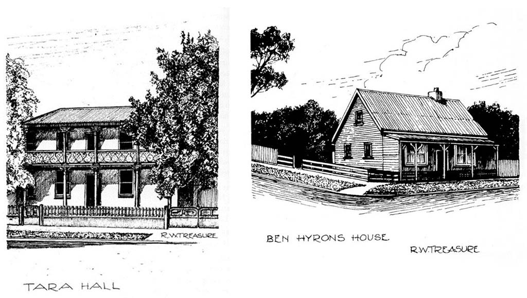
George Town was officially proclaimed as a settlement on 11 November 1804, following the arrival of Lieutenant Colonel William Patterson at Outer Cove (now known as York Cove) with a detachment of troops, convicts and one free settler. This makes George Town the oldest town in the country (the earlier settlements at Sydney and Hobart are, of course, now cities). A reasonable number of the buildings from the early 1800s still remain in the town and at Low Head. During this walk we’ll visit many of them and learn about their history. Starting from The York Cove Hotel I anticipate that we’ll finish in Low Head at either Lagoon Beach or East Beach for something to eat and drink.
|
| Sat 9 Jan 27 |
|
6.30 am |
Stein Crags |
Day Walk |
4 |
12 |
$29 |
Stein Crags is located on the Ben Lomond Plateau north east of Ragged Jack and just past Circinus Peaks. We start from Carr Villa and head up towards the Land of Little Sticks, where we turn right and go towards Old Bills Monument. From there we will head to, and then cross Circinus Peaks before dropping down to Stein Crags. Stein Crags summit is around 1350m and we will have great views of Ragged Jack from the summit.
|
| Sat 9 Jan 27 |
Sat 16 Jan 27 |
11.00 am |
Let's Explore The Labyrinth and Beyond |
Backpack Walk |
5 |
8 |
$50 |
There are a few Abels we would like to summit this summer, this trip has variable options in the planning. We hope you will join us with your sense of adventure, laughter and flexibility.
At the time of writing this preview I have done some research but exact itinerary to be confirmed. I’m adding this event to the calendar for those needing to plan annual leave. Welcome any knowledge of great campsites. Note, I have hiked the Du Cane Traverse but never been to this section.
Day 1: A Saturday, commute to Lake St Clair to catch the late ferry – pitch tents at Narcissus Hut platforms.
Day 2: Starting from Narcissus Hut, following Lake Marion Track we veer off to the track towards Mount Gould, our first camp up on the plateau.
Day 3: Mt Gould summit first up for the day, then we head towards The Guardians, looking for a campsite up along that ridgeline.
Day 4: Early morning summit to Guardians then we retrace our steps to The Minotaur. Heading north towards the Labyrinth with option to camp at Lake Ophion or further along where there is also water. More research needed if time allows us to summit Walled Mountain that day and safely continue to West Wall camp.
Day 5: Embrace boulders with day packs to Macs Mountain, then back to camp.
Note: I have no desire to bushwhack to Mt Nereus, however if someone within our group is happy to lead, I would support this if water is not a concern. We would need to allow an extra day for this.
Day 6: Option to hike down the Labyrinth to Pine Valley Hut or via Lake Elysia to head down to Cephissus Creek which finishes also at Pine Valley Hut. ** I have hiked the latter option – stunning!
Camp at Pine Valley Hut.
Day 7: Allowance for a wet weather/tent day.
Day 8: An early pack up will have us at Narcissus Hut for 11am ferry.
|
| Tue 12 Jan 27 |
Sun 17 Jan 27 |
7.00 am |
Briggs Bluff and Mt Fincham |
Backpack Walk |
6 |
10 |
$65 |
We will start from the Darwin Dam and follow the old overgrown Fincham Track for 5 km then south along the Wright River to camp under Briggs Bluff. Day trips up Briggs Bluff and Mt Fincham, then return. Some easy bouldering at the top of these two, expect some scrub. If we back it well on the way in the return will be easier.
|
| Tue 12 Jan 27 |
|
8.30 am |
Meander to Mole Creek & Return Bike |
Bike Trip |
B2 |
15 |
$29 |
We will commence our bike ride at Meander and ride the back roads to Mole Creek for lunch at the Mole Creek Hotel. We will then retrace our cycle route back to Meander. Expect around 60km in a picturesque part of Tasmania.
|
| Thu 14 Jan 27 |
|
8.00 am |
Briggs 4: Asbestos Range to Badger Head Road |
Day Walk |
2 |
12 |
$29 |
Briggs Regional Reserve is one hour's drive from Launceston and is an area of roughly 100 square kilometres of forest west of Beaconsfield and Yorktown. It consists of lowland coastal forest and has an extensive network of old logging roads, fire trails, 4WD and trail bike tracks. It is also a part of Tasmania's history with known places of ochre, iron ore, chromite and asbestos (the safe variety). It was also the first place in Tasmania where dynamite was used. Nigel Burch in his book, An Iron Will, states it is also where the Tasmanian tiger (thylacine) was discovered and where the first described fossil taxon was discovered, both in 1805.
The walks will be mostly on tracks except for the odd location where we may need to cut through 100 - 200 metres of low scrub to cut onto another track.
These will be grade 2 walks of between 10-12 km and our rate of movement will be roughly 2.5 km an hour. Our highest climb will be no more than 250 metres. The coordinator will have spare maps to hand out to anyone who wishes to practice map reading along the way.
We will leave vehicles at the junction of Hinds Mill Road and Bowens Road (height 180m) and walk 1 km along along Hinds Mill Road before cutting NE onto a taped track which we will follow for 800 metres to the southerly point of Asbestos Range. Travel will then be in a NW direction for 3 km along Asbestos Range gradually ascending roughly 210 metres to the high point and location of a Telstra antenna at 400 metres. The ridge is generally open forest with a couple of small patches of grass trees and the odd tree stump left from past timber milling operations. From this spot we will follow a 4WD track for 4 km to Badger Head Road. Before starting the walk we will need to drop off a vehicle on Badger Head Road in order to ferry drivers back to pick up vehicles. More details issued closer the the event.
|
| Sat 16 Jan 27 |
Sun 17 Jan 27 |
5.30 am |
Barn Bluff / Scott-Kilvert Hut Backpack |
Backpack Walk |
4 |
10 |
$50 |
The Scott-Kilvert Hut and Barn Bluff walk is one of my favourites in Tasmania. One of my very first overnight hikes in Tasmania was to this area many years ago! Leaving Launceston at 5.30am we will drive to the Cradle Visitors Centre, and drive through the boomgate before 8am to travel through to Ronny Creek. From here we will hike on the Overland Track up to Marions Lookout, through to Kitchen Hut, then along the Overland Track to the Barn Bluff turnoff. From this point the hike to the summit is about 3 hours return. The hike is quite steep, involves scree and incredible views from the summit. The overnight stay will be at the Scott-Kilvert Hut or surrounding camping, a convivial evening will likely occur, so please bring some treats and swimming in Lake Rodway is highly encouraged! Sunday we will walk out via the Lake Rodway Track, Artists Pool and the Rangers Hut. This area can receive any kind of weather so please be ready for all conditions.
|
| Sat 16 Jan 27 |
Sun 17 Jan 27 |
7.00 am |
Lake King William - South Kayak Base Camp |
Kayak Trip |
K1 |
15 |
$50 |
The plan is to base camp and explore the southern part of Lake King William and Laughing Jack Lagoon. Bring some luxuries and expect 12-15 km of leisurely paddling each day.
|
| Sat 16 Jan 27 |
|
8.30 am |
Alum Cliffs Tulampanga Descent |
Day Walk |
3 |
18 |
$29 |
This is a repeat of a popular short walk with the opportunity for a long swim, so get out your bathers and join me for a different perspective on those magnificent Alum Cliffs / Tulampanga area with a descent into the Mersey River. The area is rich in Aboriginal history with really good information signs. The walk drops off the main track onto a goat track used by rock climbers. There is a little scrambling where it is steep in one place, but great views from exposed ledges, before a moderate descent in open forest down to the river where there is a very large pool and rock shelves. Approx. 200 metres descent and 6km round trip, but all down and then we will retrace our steps uphill. There is some cutting grass we sometimes find near the river, so gaiters are recommended. Wetsuit and a thermos/stove is recommended for those who easily get chilled, since we will have a leisurely, long lunch break at the river and time for refreshments in Deloraine on the way home.
|
| Sun 17 Jan 27 |
Wed 20 Jan 27 |
7.00 am |
Plateau Perambulation |
Backpack Walk |
4 |
10 |
$40 |
Our plateau perambulation walk will commence at Lake Mackenzie on Sunday morning. From the car park we will walk along the dam wall and around to the replica Sandy Lake Hut and then onto Lake Balmoral where we will camp for the night. We will then walk up the valley to Lake Lucy Long and across to Weston’s Lake, where we will camp for our second night. We will walk up the valley to Lake Ironstone, around the back of Forty Lakes Peak and ascend up onto the peak, and then down to Lake Douglas and then onto Lake Fox for our third night of camping. On Wednesday we will walk across country to the end of Lake Johnny and onto Lake Explorer, where we will walk along the edge of the Lake and down to Lake Mackenzie.Come along and join me for a January holiday walk.
|
| Sun 17 Jan 27 |
|
7.30 am |
Mt Claude |
Day Walk |
4 |
15 |
$37 |
The task of getting to the summit of Mt Claude is one that is very different to probably every other in the state: after a bit of large-boulder-hopping, we make our way into a cave. Once in the cave, we have to haul ourselves up a rope through a hole in the top, and this brings us out right next to the summit! It's certainly an effort that is worth it, with superb views, particularly towards Mt Roland. We will begin our walking for the day up the road (which is in great condition but annoyingly steep!) uphill from Round Mountain lookout. Upon reaching the road we then take a track to reach the rocky outcrop that includes the summit. It won't be compulsory to do the journey to the summit via the aforementioned clambering and cave: it is ok to just wait below.
Following our summit of Mt Claude, we will continue on the Mt Claude Traverse track until we reach the saddle between Mts Claude and Vandyke. Note that this section was quite overgrown on a recent trip, so unless the organisers of the Triple Top have trimmed it recently we may have to push through a bit of light scrub. Once at the saddle, we will turn downhill and descend steeply down to finish at O'Neills Road. It should be a great through-walk - but it's a dry area so remember to bring plenty of water!
|
| Wed 20 Jan 27 |
|
8.00 am |
Low Head to Beechford |
Day Walk |
3 |
18 |
$29 |
We will commence this one-way (mainly) beach-based walk at Low Head and follow the shoreline past Three Mile Bluff, Bell Buoy Beach and Four Mile Bluff. Travelling east, we will then turn inland to bypass Five Mile Bluff - a fact that will be well-received by anyone who was on the coordinator's last journey there a decade or so ago! - and then emerge back onto the beach on the bluff's eastern side. From there, it is a comparatively easy walk to Beechford, where we can do a car-shuffle back to the bus.
If the wind happens to be blowing from the east, we may well do the walk in reverse in order to avoid head-winds.
|
| Wed 20 Jan 27 |
|
7.00 pm |
Club Meeting and Presenter |
Club Meeting |
|
|
|
|
| Thu 21 Jan 27 |
Thu 28 Jan 27 |
8.00 am |
Penguin Cradle Trail |
Backpack Walk |
4 |
8 |
$42 |
As per our previous trip in 2021 (see the detailed account in Langana 2021), the plan is to walk the entire 78km of the Penguin Cradle Trail over a relatively relaxed seven days. The route passes through the Dial Range, Gunns Plains, the Leven Canyon and the Black Bluff Range to arrive at Cradle Mt. The proposed itinerary is as follows:
Day 1 – Penguin to Hardstaff Creek campsite (Dial Range) (10km, 3h 30m)
Day 2 – Hardstaff Creek campsite to Wings Wildlife Park campsite (Gunns Plains) (10km, 5h)
Day 3 – Wings Wildlife Park campsite to Blackwood Camp (Leven River) (17km, 7h 30m)
Day 4 – Blackwood Camp to Taylors Flats (Loongana) (8km, 7h 30m)
Day 5 – Taylors Flats to Bare Mt campsite (Black Bluff Range) (14km, 8h)
Day 6 – Bare Mt campsite to Fourways campsite (east of Mt Beecroft) (11km, 4h 30m)
Day 7 – Fourways campsite to Cradle Mt Village (8km, 3h 45m)
Day 8 – Spare day
This schedule will allow us to do some of the optional side trips such as the Black Bluff summit and Mt Beecroft if we wish. If you like “journey walks” that offer a great variety of scenery and walking conditions this one should appeal. However, as we are likely to encounter some sections of scrub, fallen trees, eroded track and steep ascents and descents expect the walking to be significantly more challenging than that of the Overland Track.
Note that there is a limit of 8 for this trip and, if fully subscribed, the space limitations of some of the campsites (Bare Mt and Fourways) will require some sharing of tents.
The Penguin Cradle Trail – Map and Notes is available from the Wildcare website (near the bottom of page 2) and there is also a good description of the route on the NWWC website.
|
| Fri 22 Jan 27 |
Wed 27 Jan 27 |
9.00 am |
Lake Pedder / Serpentine Reach Kayak |
Kayak Trip |
K2 |
6 |
$65 |
This is a second attempt to make this trip happen on the Australia Day long weekend. Last year I had to cancel due to injury. The plan remains unchanged. Hope for better luck this time!
The aim of this extended kayak trip is to explore the northern half of the Lake Pedder impoundment, where it flooded over the Serpentine River course for twenty or more kilometres. It's now called Serpentine Reach, it's huge, and scattered with many small islands. We will start and finish at the Strathgordon boat ramp. Participants should be equipped to transport their kayak and gear independently to the SW. I will be driving down on the afternoon before the trip and camping at Teds Beach. Early morning travellers should meet up by 9am for around 10am on the water.
Plan A is to head down the easterly shoreline, which is less paddled, if the usually prevailing NW or N winds are not too tempestuous. I'm hoping a few kayaks will have sails, which adds a safety factor for the group. Plan B is to start down the westerly shoreline if it looks like some protection is preferable. Over two or three days we will go as far south as Crumbledown. There are a few minor lakeside peaks relatively close to two campsites which we could climb, depending on... all the factors... for those keen. Wind permitting we will return via the shore we haven't paddled and make it a loop.
Campsites large enough for 6 tents are scarce, contrary to popular stories that you can camp "just about anywhere". This may be true for one or two tents. When lake levels are low many small beaches are exposed. They look great from a distance but they are usually short , steep and rocky or pebbly. These potential campsites cannot be used for trip planning purposes. Therefore participants should be confident of paddling 15 to 20 km per day in wind and possibly choppy water to get to the next campsite. The group will be limited to 6 tents.
Please refer to the kayak and gear lists to ensure you are well prepared for a wilderness adventure. I have made this "pending aproval" as I do not know all the club paddlers. Feel free to call with enquiries. I'm dreaming of perfect weather of course and looking forward to your company - once again!
|
| Sat 23 Jan 27 |
|
7.00 am |
Bisdee Tier |
Day Walk |
3 |
14 |
$42 |
Bisdee Tier is located 125km south of Launceston. The tier is a feature of undulating countryside with a mixture of open forest, grassland and a little bit of scrub, which makes it ideal for a cross-country saunter. Located on the tier is Greenhill Observatory, operated by UTAS, and also one of the only communication dishes in the Southern Hemisphere, which can both transmit and receive signals from satellites. From our drop-off point on Lovely Banks Road, we will walk onto the main ridge and follow the ridge to the summit, have lunch close to the observatory, then zig zag across country to finish at our start point. On a clear day there are great views of the Midlands.
The distance will be 10-12km and it will take 4-5 hours to complete the walk. This is a suitable walk for new club members.
|
| Sun 24 Jan 27 |
|
6.30 am |
Smiths Tops Circuit |
Day Walk |
3 |
16 |
$37 |
Smith's Tops is located to the east of Little Pine Lagoon and is an area of high snow plains hovering between 1000 and 1200 metres. There is a historic stock man's hut which I believe survived the 2019 fire. Our aim will be to ascend to the highpoint whilst completing an attractive 12 kilometre circuit. Make sure to pack your high altitude clothing and all the usual safety equipment. The walking should mostly be fairly easy but off track.
|
| Mon 25 Jan 27 |
Wed 27 Jan 27 |
7.00 am |
Lady Lake to Mt Ironstone Circuit |
Backpack Walk |
4 |
8 |
$35 |
This trip is a nod to the fourth LWC trip in 1947 and the first overnight walk, held from 25/1 - 27/1/1947. The area covered was Western Creek to Lady Lake (Higgs Track), Lake Balmoral, Lake Lucy Long, Ironstone Lake, Ironstone Mountain.
|
| Tue 26 Jan 27 |
|
7.00 am |
Black Bluff |
Day Walk |
4 |
16 |
$42 |
Black Bluff (1339m) is 47km south-west of Ulverstone and the walk to its summit offers a good track, a range of vegetation from forest to alpine, and great views of the state’s north-west. We will be walking from Taylors Flats and the approach will be relatively gentle at first before becoming more challenging. We will walk up past the picturesque Paddys Lake on the way before tackling a final steep section to the summit, and some may wish to stay there, even have a swim, until we return.
Overall, the walk will be about 12km and will take about 6-7 hours. What a great way to spend Australia Day!
Abel-baggers should note that the ‘summit’ we will be walking to is the trig point, which some argue is not actually the high point. Given that it is already a reasonably long walk, no discussion about walking further to the ‘real’ summit will be entered into!
|
| Fri 29 Jan 27 |
|
8.00 am |
Briggs 5: Dazzler Range |
Day Walk |
2 |
12 |
$29 |
Briggs Regional Reserve is one hour's drive from Launceston and is an area of roughly 100 square kilometres of forest west of Beaconsfield and Yorktown. It consists of lowland coastal forest and has an extensive network of old logging roads, fire trails, 4WD and trail bike tracks. It is also a part of Tasmania's history with known places of ochre, iron ore, chromite and asbestos (the safe variety). It was also the first place in Tasmania where dynamite was used. Nigel Burch in his book, An Iron Will, states it is also where the Tasmanian tiger (thylacine) was discovered and where the first described fossil taxon was discovered, both in 1805.
The walks will be mostly on tracks except for the odd location where we may need to cut through 100 - 200 metres of low scrub to cut onto another track.
These will be grade 2 walks of between 10-12 km and our rate of movement will be roughly 2.5 km an hour. Our highest climb will be no more than 250 metres. The coordinator will have spare maps to hand out to anyone who wishes to practice map reading along the way.
Leaving vehicles at the highest point on Bowens Road (height 320m), we will follow the ridge line of the Dazzler Range for 3 km before linking in with a trail bike track descending 250 metres down into the headwaters of Masseys Creek. From this point we will follow a fire trail back to our finish point to join a trail bike track and then a fire trail back to Bowens Road. Total distance roughly 10 km through forest.
|
| Sat 30 Jan 27 |
|
8.00 am |
Mt Dial via Ferndene Track |
Day Walk |
3 |
18 |
$37 |
This walk will follow a track from the Ferndene Forest Reserve picnic ground, on the eastern side of the Dial Range near Penguin, to the summit of Mt Dial The track was closed quite a few years ago after a huge storm brought down a lot of trees, but it has been recently re-opened. We will climb approximately 380m to the summit of Mt Dial, and on the way we will pass through some lovely forest. We will also visit Thorsby Tunnel, an old (and long!) mining tunnel which is well worth a look - so make sure you have your head-torch! Once we reach the summit of Mt Dial we can return to the bus the way we came, but if we have a vehicle with which to do a car-shuffle we can do a through-walk along the ridgetops via Mt Gnomon and then down to Ironcliffe Road.
|
| Sun 31 Jan 27 |
|
6.30 am |
Sisters Beach - Anniversary Point Circuit |
Day Walk |
2 |
15 |
$47 |
This is a delightful 8.5km circuit at the southern end of Rocky Cape National Park. The walk will commence at the eastern end of Sisters Beach. The walk will commence with an uphill climb to Broadview Hill, the first bit has a short steep section that will climb 50m in altitude before it eases to a much gentler climb and then flattens out. We should get a good view of the coast and the surrounding countryside from here. Shortly afterwards we will turn towards the coast and head down to Anniversary Point. There is no track along the beach but the walking is easy. At the end of the beach the track climbs another 50m to the top of the headland. From here we can explore Lee Archer Cave before descending a short way to Wet Cave and then back to Sisters Beach for a swim and ice cream.
Expect about 4 hours of walking with plenty of breaks to take in the views and explore. You will need to bring water as there won't be any water on the track. Don't forget all the usual gear including raincoat (acts as a good windproof should the wind pick up!), sunhat & sunscreen, gloves and a beanie. Bathers and a towel if you want a swim. Don't hesitate to contact me if you have any questions or concerns.
|
| Tue 2 Feb 27 |
|
6.00 pm |
Seaport Saunter |
Evening Walk |
1 |
14 |
|
Join me for the annual Seaport Saunter, leaving from Hoblers Bridge Reserve at 6.00pm. We will walk to the Seaport, where we will have dinner, and then return walk to our vehicles. A very pleasant evening awaits you.
|
| Wed 3 Feb 27 |
|
7.30 am |
Minnow Falls |
Day Walk |
4 |
15 |
$29 |
The spectacular Minnow Falls tumble from the eastern side of the Mt Roland plateau in three distinct cascades, and the excellent track allows us the opportunity to visit all of them. This is a walk that has everything: a beautiful creek at the bottom, a challenging uphill climb to give you some exercise, a trip through a cave, and a few ascents via ladder!
This is a testing climb, but it is within the abilities of most regular walkers. We will visit the bottom falls for morning tea and then take the interesting section up to the second falls, where the views are excellent, for lunch. Depending on the inclination of the group, some or all of us can do the walk up to the top of the falls before returning, or we can just head back down from there.
A great walk, not to be missed!
|
| Sat 6 Feb 27 |
Sun 7 Feb 27 |
6.30 am |
Mt Field - The Watcher Circuit |
Backpack Walk |
4 |
8 |
$65 |
We will leave Newstead College at 6.30am to drive down to Lake Dobson from where we will commence our walk. We will walk past the ski village to K Col and onto Clemes Tarn where we will set up camp. Please note that we will have boulders to clamber up as we climb up the Rodway Range to K Col. We will take our time going over these. We will not be coming back this way.
Once we have set up and enjoyed a break we can explore Mt Field West and Naturalist Peak or just relax and enjoy Clemes Tarn. Plenty of options. The next morning we will pack up and retrace our steps to K Col before heading to The Watcher with the option of dropping our packs and climbing to the top. We will then descend via Lake Newdegate and walk out through Tarn Shelf.
Although this will be the height of summer please bring your thermals, beanies etc as we could encounter a cold snap. This is one of my favourite walks which I look forward to sharing with you. Please feel free to contact me if you have any questions or concerns.
|
| Sat 6 Feb 27 |
Sun 7 Feb 27 |
7.00 am |
Derwent Kayak Base Camp |
Kayak Trip |
K1 |
15 |
$47 |
We will explore the Derwent Estuary and Hobart waterfront on Saturday. The Wooden Boat Festival is on in Hobart that weekend. The plan is to stay at Base Camp Tasmania either camping $15 pp or in the dormitory $45 pp that can accommodate X 10 people. Sunday will be an explore from the Bridgewater Bridge to Montrose Bay area.
|
| Sat 6 Feb 27 |
|
9.00 am |
Navigate with Map and Compass |
Training |
2 |
8 |
|
This is a practical "hands on" training event to teach the basic aspects of land navigation using a map and compass. Subjects covered in training will be as follows:
- The differences between True North, Grid North and Magnetic North.
- Grid references, grid lines and map interpretation, including map scale and reading contours.
- Orientating a map to the ground with and without a compass.
- Taking a bearing from a map (grid bearing).
- Converting a grid bearing to a magnetic bearing.
- Estimating/measuring distance to an objective.
- Moving on a bearing to a selected objective, using the principle of "aiming off".
- Counting paces and estimating movement time in open country and close country.
The basic theory will be covered in the first hour at the Apex Hut. We will then spend 3-4 hours moving on a compass bearing from point to point, reading the ground and estimating distance. As members gain confidence with using a compass, they may wish to break into groups of two or individually and navigate on their own route back to a finish point.
Equipment: Bring a daypack, chair or stool, notebook and pencil and an adjustable dial compass (sometimes called a baseplate compass - examples include such brands as Silva and Suunto). Maps will be provided. Several club compasses will be available to use if you do not have a compass for this training.
Transport: Own vehicle to Apex Hut, Lake Trevallyn Road, Trevallyn Nature Recreation Reserve.
This event would be useful for Prospective and New Members. All Members are welcome. At the end of this training, you will have the basic knowledge to continue developing your navigation skills by map reading (reading the ground) while participating in club walks. This event will finish at or about 3 pm.
|
| Sun 7 Feb 27 |
|
8.00 am |
Warners Track, Adams Peak and Pool Plunge |
Day Walk |
3 |
10 |
$35 |
Warners track starts near Jackeys Marsh and follows up Burnies Creek up onto the Central Plateau. It is a moderately steep but well graded wide track (old stock-route) that zig-zags up the Great Western Tiers / Kooparoona Niara through open regrowth forest. There are some pretty pools near the top that would be great for a plunge if we feel like refreshing ourselves. Once on top, the track becomes braided but well-worn in the low vegetation, and it's only a short distance to get to the top of Adams Peak. There are great views from the summit. We then retrace our steps down.
Car parking is very limited, so carpooling is required. Please contact me first if you are not based in Launceston.
|
| Mon 8 Feb 27 |
Wed 10 Feb 27 |
8.00 am |
Lake Fanny Backpack Walk |
Backpack Walk |
3 |
8 |
$40 |
Join me for a leisurely backpacking walk to Lake Fanny, commencing at Ada Lagoon. We will walk in on a track and camp at a suitable spot on the northern side of the lake. On the second day, we will do a day walk up to New Years Lake and then across to Lake Butters. We will complete a circuit from there and back to our camp site. Our day two walk is all off-track. On day three, we will walk back to Ada Lagoon and our vehicles and head home. This walk is suitable to club members who are keen to try back packing walks.
|
| Thu 11 Feb 27 |
|
7.30 am |
Rossarden Falls |
Day Walk |
2 |
18 |
$29 |
Rossarden Falls is located on the Tasmania Ck West of the Rossarden village. Depending upon the volume of water the falls can be quite spectacular. It is an easy short walk which can be made an hour longer by descending to the base of the falls. This is a little more challenging. We will fill in our day with a second short walk at nearby Gipps Creek.
|
| Fri 12 Feb 27 |
Sun 14 Feb 27 |
7.00 am |
Mt Sorell |
Backpack Walk |
5 |
8 |
$65 |
Mt Sorell is an Abel standing at 1144m and is the most south-westerly of all the West Coast peaks. This amazing area is best enjoyed over 3 days with 2 nights of camping either side of a day walk to the summit.
We will leave Launceston on the Friday morning at 7am and travel to Queenstown on the West Coast then drive along the Kelly Basin Road to Purgatory Gap where we will leave the cars and start our walking adventure.
The walk starts on a 4WD track and heads steeply to the Darwin Plateau to a T-junction. We will then head left (south) along the plateau and locate a campsite with a reasonable water source at the Clark Valley.
Saturday we will have an early start with well-equipped day packs for our day trip to Mt Sorell. The walk descends for 350m to the Clark River and the valley floor is crossed westward to the base of the ridge. The hike to the summit is scrubby and cliffy and a challenge but the summit is worth the effort with plenty of views on a good day. This will be a long day of at least 8 hours depending upon weather conditions. Sunday we will return to the cars.
This is a walk for experienced members in both backpacking trips and scrub. I look forward to the adventure.
|
| Sat 13 Feb 27 |
|
7.30 am |
Mt Pillinger |
Day Walk |
4 |
12 |
$37 |
Anyone who knows the coordinator of this trip will know that he is always banging on about Mt Pillinger being the best 'bang for your buck' in the state, in terms of the reward you get from the walk in return for the amount of effort spent getting there. The climb is not overly arduous, particularly via the Maggs Spur 17 track which is the way we are going - although there is a fair bit of boulder-hopping in the middle section and a bit of steep climbing near the top. In return for that, once you are on the narrow summit ridgetop you get breathtaking views of almost all of the mountains in the Overland Track area, Lees Paddocks, The Walls, and plenty more.
Come along and join the coordinator on his tenth ascent of this iconic mountain!
|
| Sun 14 Feb 27 |
|
8.00 am |
Natunu / St Valentines Peak |
Day Walk |
3 |
15 |
$37 |
Natunu- Valentines Peak is a distinctive Abel in our North West. The fancy bridge just after the start means that we can have dry feet. It is consistently uphill to the ridge line for views. The last thirty minutes across to the summit offers a bit of a challenge for those who don't like drop offs. It may be a popular destination for other walkers on this day. Expect about 2.5 hours of walking eaçh way.
|
| Mon 15 Feb 27 |
|
6.00 pm |
Hardwicke St / Dalrymple St Ramble |
Evening Walk |
2 |
|
|
This walk is on two City of Launceston trails linking the beautiful, leafy surroundings of the Hardwicke Street Reserve that joins West Launceston to the Duck Reach Power Station. It’s 2.2km in length and a trail with a breathtaking view of the South Esk River and open grasslands. The total length of the two trails is 4.3km. Whilst the walk is graded 2, there are some rocky and hilly sections.
|
| Tue 16 Feb 27 |
|
7.00 pm |
Safety/Coordinator Meeting |
Club Meeting |
|
|
|
Details to follow.
|
| Wed 17 Feb 27 |
|
8.30 am |
Pine Lake to Lake Huntsman Bike |
Bike Trip |
B1 |
18 |
$37 |
This ride is mostly downhill. It may be a bit cool for the first part down from the plateau to Golden Valley. It is then relatively flat to Meander. The last hill before our finish is called 'the Grunter' for good reason!
|
| Wed 17 Feb 27 |
|
7.00 pm |
Club Meeting and Presenter |
Club Meeting |
|
|
|
|
| Fri 19 Feb 27 |
Sun 21 Feb 27 |
5.00 pm |
Hartz Peak and Surrounding Lakes and Waterfalls |
Base Camp Walks |
4 |
8 |
$65 |
Hartz Peak and its surrounding waterfalls and lakes is one of my favourite southern Tasmania hikes. Hartz Peak is a 1254m dolerite peak and is the highest peak in the Hartz National Park. The hike has a 400m elevation gain and takes between 4-5 hours return depending how often you stop to take photos. The distance is 7.4km return. Whilst the beginning of the walk is well tracked, there are some tree roots to deal with and there is a steep and rocky scramble to the summit. On a clear day, the views are amazing.
The intention is to drive down to Geeveston (just over 3 hours) on the Friday evening and camp, either at the Arve River camp ground or on my sister's acreage property in Glendevie (11 minute drive south of Geeveston). An early rise on Saturday morning will allow us ample time to drive to the carpark of Hartz National Park and explore Lake Esperance and Ladies Tarn, both on the way to the summit of Hartz Peak.
If time permits, and for those who are keen, a walk up to Lake Perry (3.2km return Grade 4 narrow, overgrown and muddy track) will take place, passing Lake Osborne (Grade 2 - easy and well-formed track with a gentle incline) on the way. This section is approximately 1.5 hours return. Driving down from the car park at Hartz National Park, we will stop for the 30 minute stroll to Arve Falls.
Sunday morning we will explore Snug Falls on the way home. Snug Falls is a gorgeous high waterfall on Snug River. The hike is just over 2km; the track can be a bit slippery, muddy and rough in places if there has been rain. Once at the base of Snug Falls, there is an enchanting large waterfall, that drops into a narrow gorge like amphitheatre. A good level of fitness is required as this will be a full weekend of exploring.
|
| Sat 20 Feb 27 |
|
6.30 am |
Legges Tor, Markham Heights and Misery Bluff |
Day Walk |
4 |
12 |
$24 |
The walk commences from Carr Villa. We follow the marked track, which takes us to the summit of Legges Tor, second highest peak in Tasmania. Then we retrace our steps to the Plains of Heaven where we head off track in a northerly direction to Markham Heights. From here we descend to Misery Bluff on our way back to the main track. From Misery Bluff to the main track we are on rough scrubby terrain.
|
| Sat 20 Feb 27 |
|
7.00 am |
Bay of Fires Lagoons Kayak |
Kayak Trip |
K1 |
15 |
$55 |
This is a kayak trip with a difference in that we will explore four different lagoons near St Helens. The waterways should be protected from most winds. We will explore Diana's Basin, Grants Lagoon, Sloop Lagoon and Long Lagoon. If you need to borrow a kayak please contact the coordinator BEFORE registering.
|
| Sun 21 Feb 27 |
|
8.00 am |
Badgers Range Traverse |
Day Walk |
4 |
18 |
$29 |
Badgers Range lies to the north-east of Sheffield. It is not a particularly high range, with its highest point only being about 250m above the surrounding fields, but all the way along the range there are numerous lookouts that offer great views to the east west, plus terrific views towards Mt Roland from the range's southern end.
We will commence our traverse of the range at Morgans Road and follow the Badgers Ridgeline track in a south-easterly direction, eventually travelling over Kimberleys Lookout and descending to Badger Road. It is a longish walk with plenty of up and down, particularly a significant climb out of Badgers Gorge, but is a definitely a worthwhile day out!
|
| Mon 22 Feb 27 |
Fri 26 Feb 27 |
7.00 am |
Leonards Tarn and Surrounds |
Backpack Walk |
5 |
8 |
$40 |
This 5-day trip will aim to visit Leonards Tarn in the Cradle Mt - Lake St Clair NP and some of its surrounding peaks. The proposed, somewhat flexible itinerary, is something like:
Day 1 – Walk into Pelion Plains on the Arm River Track and then follow the Overland Track north to camp at either Frog Flats or Pine Forest Moor.
Day 2 – Proceed to the start of the Pelion West Track but traverse off-track below it's cliffs on the southern side and then onto the arcing, open ridge to below Mt Achilles and then down to Leonards Tarn to camp. Possibly climb Mt Achilles on the same day.
Day 3 – Climb Mt Achilles if not done on Day 2. Visit Perrins Bluff as a day walk.
Day 4 – Either climb Mt Thetis as a half-day walk, returning to Leonards Tarn, before heading down the scrubby valley to Frog Flats and camp, or carry packs over Mt Thetis and camp below Paddys Knob.
Day 5 – Walk out. If leaving the camp below Paddys Knob follow the partly-marked route out to the Overland Track.
|
| Mon 22 Feb 27 |
|
7.30 am |
Bay of Fires Bike |
Bike Trip |
B2 |
18 |
$47 |
Depending on the wind direction, we will ride from Beer Barrel Beach to The Gardens or the other way. It is about 40 kms in distance on sealed road, separated shared pathways and a brief section of gravel road. There will be stops at beaches, opportunities to swim and the chance to check out the St Helens MTB Park.
|
| Tue 23 Feb 27 |
|
6.00 pm |
Gravelly Beach to Swan Point |
Evening Walk |
2 |
|
$24 |
Come along on this relatively easy 6km walk from Patricias Beach at Gravelly Beach to Swan Point / Paper Beach & back again. This is a local walking track so you never know what you might spot along the way. If time permits and the weather is warm enough there might even be a chance to go for a swim. We should be able to spot lots of wildlife so make sure you bring a headlamp, dinner & warm clothing.
|
| Sat 27 Feb 27 |
|
6.30 am |
Working Bee |
Working Bee |
4 |
10 |
$0 |
This track we have marked and cleared to the plateau. We are revisiting the area to mark and clear across to the summit. This will involve hedge trimmers and brush cutter as well as hand tools. It is a steep ascent and then you are on top.
More details will be provided nearer to the time.
|
| Sun 28 Feb 27 |
|
6.30 am |
Bull Hill |
Day Walk |
3 |
14 |
$40 |
The Bull Hill stock lease was operated from the mid 19th century and there was still a 3 sided shelter hut present at my last visit in 2022. The walking is on track as far as the hut site, then becomes a little more challenging. We will reassess the final summit route and this will certainly be optional. Time permitting we will complete a circuit possibly following Coblers creek some of the way back to the cars. A most beautiful alpine environment deserving of more club visits.
|
| Sun 28 Feb 27 |
|
7.30 am |
Erriba to Turners Beach Bike |
Bike Trip |
B2 |
16 |
$37 |
A mostly down hill ride through some of the most scenic countryside in NW Tas. Finish with a swim and icecream.
|
| Mon 1 Mar 27 |
|
10.00 am |
Legges Tor from Carr Villa |
Day Walk |
3 |
12 |
$24 |
This is a classic walk close to home at our closest national park Turipina/ Ben Lomond. It is steadily uphill to the plateau and then we follow the snow poles to the summit of the second highest mountain in our island state. Expect about 10 kilometres or 4-5 hours of leisurely alpine exploring. There are a couple of sections of scree.
|
| Fri 5 Mar 27 |
Mon 8 Mar 27 |
7.00 pm |
SW Kayak Base Camp |
Kayak Trip |
K1 |
15 |
$52 |
We will travel down on Friday night. We will base camp at Teds Beach and day explore parts of the lake and Lake Gordon. Expect about 12-15 km of paddling each day.
|
| Sat 6 Mar 27 |
Fri 12 Mar 27 |
5.00 am |
Du Cane Traverse |
Backpack Walk |
5 |
8 |
$50 |
Details to follow but likely itinerary;
Day 1. Exit early from Launceston or meet at LSC office at 8:30am for 9am ferry to Narcissus Hut.
Narcissus Hut to Pine Valley Hut for lunch, up Labyrinth Track to Lake Elysia or Pool of Memories being our campsite.
Day 2. Du Cane High Point to Mt Hyperion - campsite to be confirmed. (I have not hiked Hyperion)
Day 3. Back to "track" to descend Big Gun Pass to Massif Bowl campsite - only 20 min hike to summit perfect for sunset.
Day 4. Massif Bowl to Castle Crag and Falling Mountain - embrace the boulders day! Camp in saddle but limited water.
Day 5. Exit Falling Mtn by scrub bash down to Overland Track to Du Cane Gap.
Camp at bowling green or Narcissus Hut platforms depending on Ferry time.
Day 6. Exit Day via ferry and drive back to Launceston.
Day 7. Wet weather/tent day option.
Look forward to your company.
|
| Sat 6 Mar 27 |
Mon 8 Mar 27 |
7.00 am |
Chinamans Plains Circuit |
Backpack Walk |
4 |
8 |
$40 |
An exploration of this remote part of Walls of Jerusalem National Park. We will most likely enter via Lake Meston and exit via Lake Adelaide, camping beside lakes on two nights. Previous backpack experience essential.
|
| Sat 6 Mar 27 |
|
9.00 am |
Kate Reed Recreation Area |
Day Walk |
2 |
15 |
|
The walk will start (Meeting Point) at the car park under the Midlands Highway overpass on Kings Meadows Link Road (near Bunnings).
We will do a circuit walk around Kate Reed, which will be mainly on mountain bike tracks. The walk time will be less than 4 hours with a distance close to 10 kilometres. Good walk and we don’t have to leave Launceston.
|
| Sat 13 Mar 27 |
|
8.00 am |
Mt Montgomery Circuit |
Day Walk |
3 |
18 |
$37 |
In February 2025 the club took its first walk on the new track that descends on the southern side of Mt Montgomery, near Penguin. It was a lovely track but the weather was awful so we ended up missing out on what we thought would have been great views. So - we're having another go!
We'll begin this trip by walking to the summit of Mt Montgomery - steep but fairly short! We'll then take our time on the new downhill section, eventually arriving at the lovely tree-ferns at Keddie Creek, probably for lunch. From there we'll climbing north up to the saddle between Mts Dial and Montgomery, and then connect up with the track we came up on. We'll retrace our steps from there back to the bus.
We should definitely have time for a drink and/or a swim in Penguin afterwards!
|
| Sat 13 Mar 27 |
|
10.00 am |
Pine Tier Lagoon Kayak |
Kayak Trip |
K1 |
12 |
$30 |
This will be another kayak day trip. We will explore the northern end of the lake and explore down the lake and exit at the boat ramp. If you need to borrow a kayak please contact the coordinator before you register.
|
| Sun 14 Mar 27 |
|
8.00 am |
Paradise Bike |
Bike Trip |
B1 |
15 |
$37 |
We will ride from Staverton at 535m asl to Kimberly at 100m asl through mostly quiet bitumen country roads and mostly downhill. There will be some sections of smooth gravel through Beulah, so a hybrid bike might be a good choice. Finish with an icecream at Elizabeth Town. Bus supported all the way.
|
| Mon 15 Mar 27 |
Thu 18 Mar 27 |
5.30 am |
Hydrographers Hut & Razorback Falls |
Backpack Walk |
4 |
8 |
$50 |
The Hydrographers Hut (often abbreviated as the “Hydro Hut”) is situated about 4km to the east of Lake Windermere in the Cradle Mt - Lake St Clair National Park. It was built in the 1960s by the HEC to record rainfall and water flow data for the Mersey-Forth hydro-electric power scheme. It is now maintained by PWS.
We’ll follow the Overland Track from Ronny Creek to Lake Holmes and then go off-track through what should be reasonably open country, but perhaps with some bands of scrub. Where we camp will depend on our progress – it could be in the vicinity of Lake Agnew or we might make it to the hut. The next day I’d like to carry daypacks beyond the hut, following the creek down to Commonwealth Creek to inspect the remains of the Barn Bluff Copper Company mine which operated, somewhat unsuccessfully, in 1903-4. Nearby are two sets of waterfalls: Myra and Razorback. If time allows a visit to Lakes Ellen and McRea would make a nice circuit back to the hut.
Day 3 could provide us with an opportunity to visit some additional lakes (such as Lake Andrews) and tarns in the area before camping somewhere closer to the Overland Track. We’ll return home on day 4.
You’ll note that the overall plan is quite flexible, to accommodate possible variations in walking progress and weather conditions. There’s an informative video showing the hut, its surrounds, some of the mining remnants and one of the waterfalls at https://www.youtube.com/watch?v=2dI_hcHoBAY.
If participants prefer not to have a really early start on Monday then we could complete most of the travelling on Sunday afternoon/evening eg staying at O’Neills Creek Campground at Gowrie Park or somewhere along the Cradle Mt Road.
|
| Wed 17 Mar 27 |
|
8.00 am |
Barrow High Plains |
Day Walk |
3 |
18 |
$30 |
This will be a circuit walk around the Barrow Plains which are located at 1000 metres. The walking is mostly off track but relatively easy and the scenery sub alpine and most attractive. Wildlife can be plentiful. Some lovely patches of rainforest too. Make sure to bring your alpine Woolies, if windy Mt Barrow can be extremely cold.
|
| Wed 17 Mar 27 |
|
7.00 pm |
Club Meeting and Presenter |
Club Meeting |
|
|
|
|
| Thu 18 Mar 27 |
|
8.00 am |
Legerwood to Derby Bike & Bathe |
Bike Trip |
B2 |
15 |
$29 |
We will ride on sealed roads from Legerwood to Branxholm - about 11km, have a morning coffee at the cafe, then pick up the beautiful Valley Pond Branxholm Derby Link for 10km, and Riverside Trail in Derby. Lunch in Derby and then Lake Derby Circuit to wet your appetite for a swim!
These are easy/beginner MTB trails. Valley Pond Branxholm Derby Link introduces features such as berms, rollers and shallow river crossings and it follows the Ringarooma River. There are giant Man ferns along this trail and the opportunity to spot a basking platypus at Valley Ponds... although I have only spotted lycra-clad club members basking at picnic tables there!
Finish at the lake for a swim, then ice-cream?
|
| Sat 20 Mar 27 |
Sun 21 Mar 27 |
7.00 am |
Fisher Bluff |
Backpack Walk |
4 |
8 |
$40 |
Fisher Bluff is a peak at 1408m on the Central Plateau near Lake Mackenzie. This backpacking walk commences near Lake Mackenzie Dam wall and heads off on the Blue Peaks Track before heading off west towards Fisher Bluff. The camping area is limited hence the limit of 8. We will either hike up to the summit on the Saturday afternoon or the Sunday morning depending upon conditions. This is a special sensitive area to walk in. Walkers need to be experienced and can handle some off-track. If tents can be shared please that would be good as tent sites are limited! Please feel free to join me for a happy weekend but please come prepared for all conditions weather-wise.
|
| Sat 20 Mar 27 |
Tue 23 Mar 27 |
7.00 am |
Little River Descent |
Backpack Walk |
5 |
8 |
$50 |
Walk begins at the WOJ carpark, so initially we have the climb up to Trappers hut to contend with followed by the cross country ramble down to Lake Adelaide. We then leave tracks behind and traverse onto the Chinaman's Plains to find our first nights camp. Next morning we will find the beginning of the river, which we will follow for three days all the way to its Junction with the river Nive. The juvenile stream flows thru Lakes Nugara, Three Arm Lake, Pogana and Pat's Tarn before descending thru Lake Olive. Although the coordinators aim will be scrub minimisation, he is still convinced that we will certainly encounter some. Participants need to be mentally prepared for some physical challenges, also preferably have some experience with off track adventuring. Total distance looks to be around 50 kilometres with most of the climbing on the first morning.
|
| Mon 22 Mar 27 |
|
8.30 am |
Chudleigh Bike |
Bike Trip |
B2 |
18 |
$29 |
The plan is to ride from the road high point on the Gog Range to Chudleigh via Wet Cave and Westmorland Falls. There may even be a chance for a swim at Caveside Pool and of course ice creams at the finish. Expect about 40 kilometres of leisurely riding on mostly sealed roads. Bring sturdy footwear and a head torch if you want to explore Wet and Honeycomb Caves. There is the option to walk to the Falls.
|
| Fri 26 Mar 27 |
Wed 31 Mar 27 |
8.00 am |
Macquarie Harbour Kayak |
Kayak Trip |
K2 |
8 |
TBA |
Detailed plan to be worked out soon. Five or 6 days of remote kayaking adventure on Maquarie Harbour and Gordon River. The trip plan will depend on whether we are able to book on the Harbour Master or not and how many kayaks they can take. The dates may need to be tweaked a bit.
|
| Sat 27 Mar 27 |
Sun 28 Mar 27 |
7.00 am |
West Coast Day Walks |
Base Camp Walks |
4 |
16 |
$65 |
This walk will take in two lovely walks not far from Zeehan. Both walks will involve a bit of steep climbing at times and could potentially be slippery, but the walks are not overly long and offer good reward for your efforts.
After an early start in Launceston on the Saturday, we will tackle the walk to Fraser Creek Hut, just north of Mt Dundas. The hut is run by the Scout Association and is well worth a look, as is the surrounding forest.
Our Sunday walk will be to Mt Agnew, to the north-east of Zeehan. There is some beautiful thick forest to walk through on the way up, but things open up near the top and offer a great view of the coast.
Of course, since this is a base-camping trip, participants are invited to bring any decadent food and drink items that their heart desires!
|
| Fri 2 Apr 27 |
Sun 4 Apr 27 |
3.00 pm |
West Coast Bike Base Camp |
Bike Trip |
B3 |
16 |
$47 |
This is a bike base-camping weekend with a difference because we will be staying overnight at a house in Rosebery that is owned by a club member. The first in to register will most likely get to sleep in a bed, and the next few can sleep indoors on the floor with the help of an air mattress. Late registrants may have to bring a tent or vehicle to sleep in.
Participants are encouraged to bring plenty of food and drink to help make this a great social event as well as a great ride.
Our first day’s riding will begin at the start of the Montezuma Falls Track and head west to emerge on to the Murchison Highway just near Melba Flats. If there is time, we may continue on into Zeehan. There is some superb forest in the Montezuma Falls area and it is a very attractive ride, to say nothing of the fact that the falls themselves are spectacular. Be aware, however, that upon reaching the falls, riders will be required to wheel their bikes across the swing-bridge just downstream. This may seem daunting to some, but plenty of help will be available and this is something we have achieved successfully in the past.
The remainder of the riding for the weekend will be determined closer to the event, but will definitely include a journey through the Spray Tunnel just near Zeehan (so bring your bike headlamps!).
Please note
- a mountain bike is very strongly recommended for this trip, or at the very least a sturdy hybrid. Some of the riding may be a bit rough in places.
- the bus for this trip will depart at 3pm on the Friday, so if you are one of the working fraternity you will need to take Friday afternoon off or travel down separately.
|

